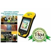
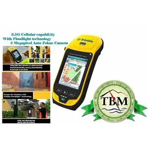
Detail Trimble GeoXH 6000 ( 3, 5G Edition, With Floodlight)
The accuracy you need anywhere you need it
Bringing together the essential functionality for productive GIS data collection in one device. The Trimble® GeoExplorer® 6000 series also delivers positioning accuracy in challenging GNSS situations such as under trees and near buildings with Trimble Floodlight™ technology. Wherever you work, it just works.
Choose either the GeoXH or GeoXT 6000 series model to suit your needs:
Product Models GeoXT GeoXH
Accuracy Submeter Decimeter/ Centimeter
Floodlight Optional Yes
Cellular modem Optional Optional
Camera 5 MP 5 MP
Satellite shadow is the number one problem for data collection teams needing high accuracy
in difficult GNSS conditions. Trimble® Floodlight™ satellite shadow reduction technology is the
solution— delivering dramatic improvements to accuracy and position availability when
working in urban canyons and under tree canopy.
Satellite shadow prevents position acquisition in difficult GNSS environments
WHAT IS SATELLITE SHADOW?
Satellite shadow occurs when an obstacle between a GNSS satellite
and a receiver stops the receiver from tracking the satellite effectively.
As more satellites are blocked from view, it becomes progressively
more difficult for the receiver to compute accurate positions. In
extreme cases there are simply too few satellites in view to compute
positions at all.
HOW DOES FLOODLIGHT TECHNOLOGY MITIGATE SATELLITE SHADOW?
Trimble Floodlight technology reduces the effects of satellite shadow in three ways:
1. By combining GPS and GLONASS tracking, satellite availability is increased by up
to 60% over GPS-only positioning.
2. Advanced tracking algorithms speed up signal acquisition and ensure more
stable tracking of satellites with weakened signals. With steadier tracking comes
smoother positioning that is less prone to drop-outs and spikes caused by erratic
satellite tracking.
3. Floodlight technology uses altitude-constrained positioning to reduce the impact
of weakened or blocked signals. This technique limits the impact of weak signals,
allows 3D positioning with fewer satellites, and improves horizontal and
vertical accuracy.
Floodlight technology is compatible with real time and postprocessed workflows.
There is no extra configuration, back-office processing, or quality control required—
it just works.
Why is Floodlight technology better than othe r techniques to
improve position availability?
Receivers that address satellite shadow by offering GPS and GLONASS positioning
are only solving part of the problem.
Other solutions that use lower quality thresholds may increase position yield in
obstructed conditions, but do so at the expense of accuracy. Floodlight technology
tackles satellite shadow by improving satellite visibility and tracking while
safeguarding against the effects of weak satellite signals on position quality—
achieving the best possible position.
Tampilkan Lebih Banyak